Mount Everest Located: The World’s Highest Peak
6th July, 2025 - Posted By: Himalayan AbodeMount Everest, the highest mountain on Earth, is a symbol of natural wonder, adventure, and human achievement. If you’re searching for “Mount Everest located,” you’re likely curious about its exact position, its significance, and the fascinating geography that surrounds it. This comprehensive guide will answer all your questions, using the latest data and SEO best practices to ensure you find everything you need to know about Mount Everest’s location and more.
Where is Mount Everest Located?
Mount Everest is located in the Mahalangur Himal sub-range of the Himalayas, straddling the border between Nepal and the Tibet Autonomous Region of China. Its summit marks the precise boundary between these two countries, making it a shared natural wonder.
- Coordinates: 27°59′18″N latitude, 86°55′31″E longitude
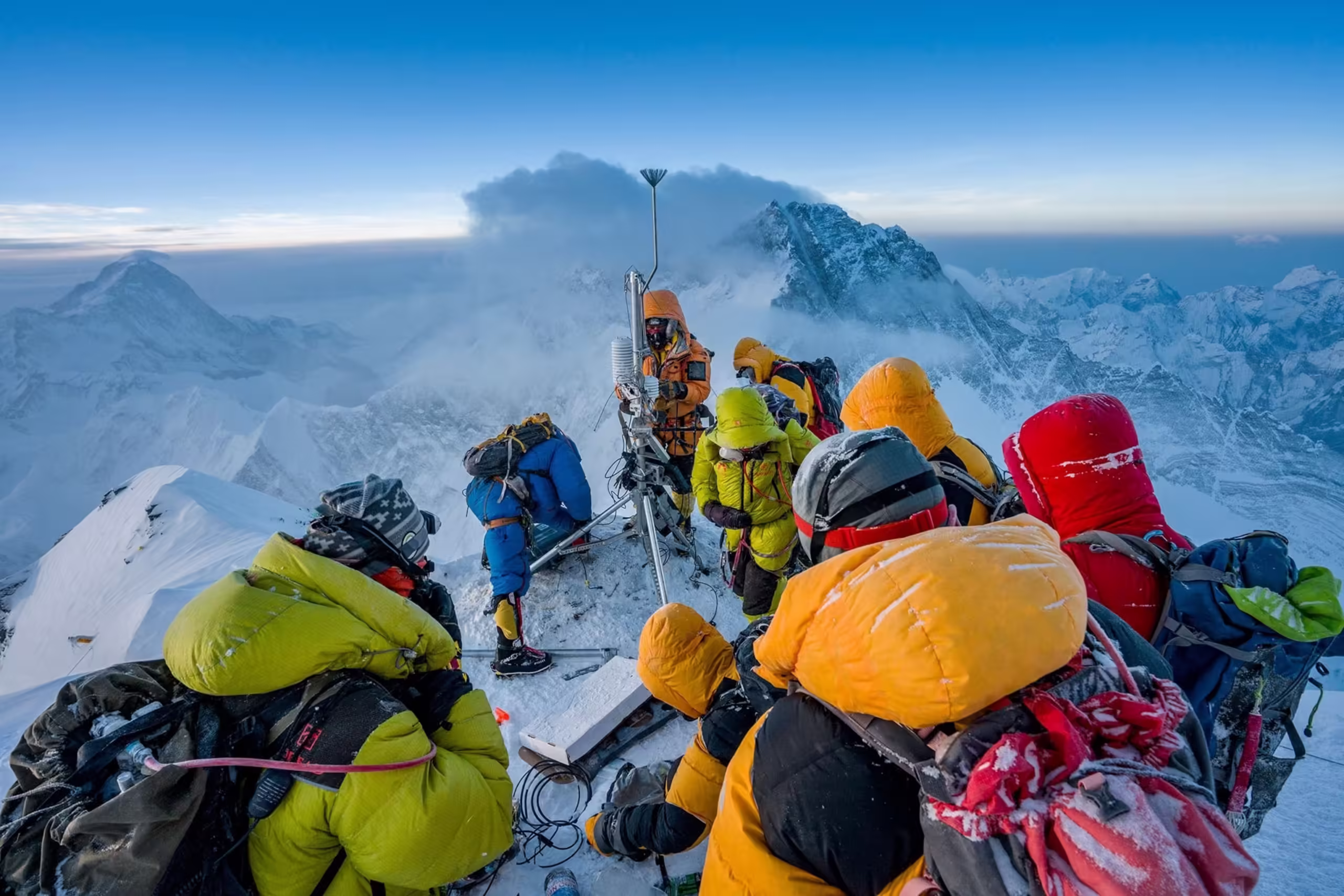
- Elevation: 8,848.86 meters (29,031.7 feet) above sea level, as officially measured in 2020 by Nepal and China
Geographical Context: The Heart of the Himalayas
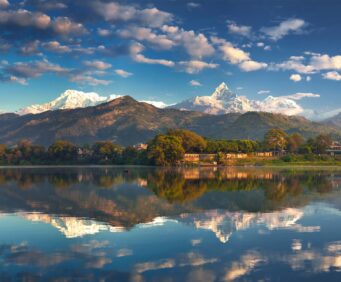
Mount Everest rises from the central Himalayas, the world’s highest mountain range, which extends across five countries: Nepal, China (Tibet), India, Bhutan, and Pakistan2. Everest itself forms a natural border between northeastern Nepal’s Solukhumbu District and Tibet’s Tingri County.
Key Facts:
- Nepal Side: Located within Sagarmatha National Park, a UNESCO World Heritage Site
- Tibet Side: Part of the Qomolangma National Nature Preserve
- Nearby Peaks: Lhotse, Nuptse, Makalu, and Cho Oyu
Local Names and Cultural Significance
Mount Everest is known by different names in the regions it touches:
These names reflect the mountain’s deep cultural and spiritual significance for local communities.
The Border: Nepal and China
The China–Nepal border runs for 1,389 kilometers (863 miles) along the Himalayas, with Mount Everest as its most famous landmark. The summit itself is the international boundary, and both countries have historically cooperated on its management, including joint surveys and environmental agreements.
The Formation and Growth of Mount Everest
Mount Everest’s location is not just a matter of geography—it’s a story of tectonic forces. The Himalayas were formed millions of years ago when the Indian tectonic plate collided with the Eurasian plate, a process that continues today. This ongoing collision means that Everest is still growing, albeit slowly.
How to Reach Mount Everest
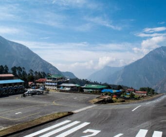
From Nepal (South Side)
- Gateway City: Kathmandu
- Popular Route: Fly to Lukla, trek through Namche Bazaar to Everest Base Camp (EBC)
- Protected Area: Sagarmatha National Park
From Tibet (North Side)
- Gateway City: Lhasa or Shigatse
- Popular Route: Drive to Rongbuk Monastery, then trek to the North Base Camp
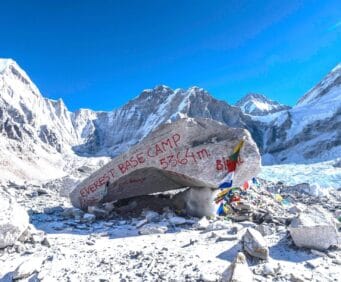
Everest Base Camps: Two Approaches
| Base Camp | Location | Altitude | Access Route |
|---|---|---|---|
| South Base Camp | Nepal | 5,364 meters | Trek from Lukla via Namche |
| North Base Camp | Tibet, China | 5,150 meters | Drive from Lhasa/Shigatse |
Why is Mount Everest’s Location Important?
- Geopolitical Symbol: The mountain is a symbol of cooperation (and sometimes tension) between Nepal and China.
- Tourism Hub: Everest draws thousands of trekkers and climbers each year, supporting local economies and global adventure tourism.
- Environmental Significance: It is a key area for climate research, biodiversity, and conservation efforts.
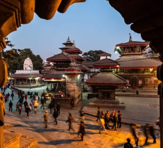
Mount Everest in Nepal: Sagarmatha National Park
On the Nepalese side, Mount Everest is the crown jewel of Sagarmatha National Park, a UNESCO World Heritage Site renowned for its dramatic landscapes, unique Sherpa culture, and rich biodiversity. The park is home to rare species such as the snow leopard, red panda, and Himalayan tahr.
Key Villages:
- Namche Bazaar: The main hub for trekkers and climbers
- Tengboche: Famous for its Buddhist monastery with views of Everest
Mount Everest in Tibet: Qomolangma National Nature Preserve
On the Tibetan side, Everest lies within the Qomolangma National Nature Preserve, which protects the northern slopes and supports Tibetan culture and wildlife.
Highlights:
- Rongbuk Monastery: The highest monastery in the world, with stunning views of Everest’s north face
- Tingri County: The administrative region for the Tibetan side of the mountain
The Surrounding Peaks and Valleys
Mount Everest is surrounded by several other iconic peaks:
- Lhotse (8,516 m): The fourth highest mountain, just south of Everest
- Nuptse (7,861 m): Forms the western side of the Everest massif
- Makalu (8,485 m): Fifth highest, located southeast of Everest
- Cho Oyu (8,188 m): Sixth highest, to the west
These peaks create a dramatic skyline and are part of the reason the region is so popular among trekkers and climbers.
Historical and Modern Borders
The exact border at Everest’s summit was formalized in treaties between Nepal and China in the 20th century, following the annexation of Tibet by China4. Today, the summit is a literal and symbolic meeting point of two nations, with climbers from both sides often meeting at the top.
Frequently Asked Questions
Is Mount Everest in Nepal or China?
Mount Everest is on the border between Nepal and China (Tibet Autonomous Region). The southern slope is in Nepal, while the northern slope is in Tibet, China.
What are the exact coordinates of Mount Everest?
27°59′18″N latitude, 86°55′31″E longitude.
How high is Mount Everest?
8,848.86 meters (29,031.7 feet) above sea level.
What is the closest city to Mount Everest?
- Nepal Side: Namche Bazaar is the main gateway for trekkers.
- Tibet Side: Tingri is the nearest major town.
Which country owns Mount Everest?
Both Nepal and China share Mount Everest, with the summit marking the international border.
Mount Everest on the Map
Mount Everest’s unique location makes it a point of interest for geographers, adventurers, and travelers worldwide. Its position at the roof of the world is marked on every major world map, and its coordinates are used as a reference point in global navigation.
Climbing and Trekking: Why Location Matters
The mountain’s location affects everything from weather patterns to climbing routes. The southern (Nepalese) route is the most popular for climbers, while the northern (Tibetan) route offers a different set of challenges and scenery.
- Best time to visit: Pre-monsoon (April–May) and post-monsoon (September–November)
- Permits required: Both Nepal and China require special permits for climbing or trekking near Everest
Environmental and Conservation Efforts
Both Nepal and China have established protected areas around Everest to preserve its fragile environment and unique biodiversity. These efforts are crucial, given the increasing number of visitors and the impact of climate change.
Recent Posts