Where Is Mount Everest? Guide to the Location, Height, Facts & More
3rd August, 2025 - Posted By: Himalayan AbodeWhere Is Mount Everest? Understanding the Location
Mount Everest, the world’s tallest mountain, captivates explorers, trekkers, and adventure seekers globally. But the question, “Where is Mount Everest?” is more nuanced than a simple country name. This in-depth guide covers everything from its precise coordinates to its geopolitical significance, environmental realities, and travel insights.
Where Is Mount Everest Located? Geographical Coordinates and Border Context
Exact Coordinates of Everest
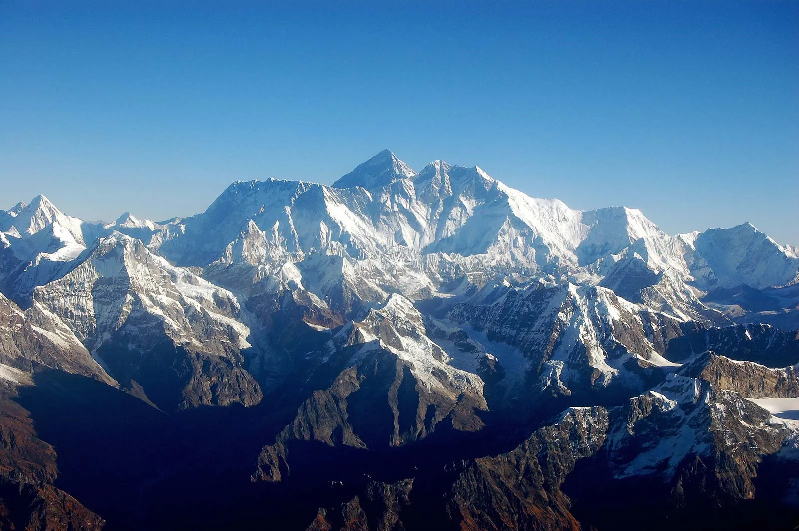
To pinpoint where Everest is located, the summit sits at 27.9881° North latitude and 86.9250° East longitude.
This places is directly on the international border line separating Nepal to the south and the Tibet Autonomous Region of China to the north.
Border Between Nepal and China: Where Is Mount Everest Country?
One of the most searched questions related to where is Mount Everest is: “which country owns Everest?” The truth is that Mount Everest straddles both countries.
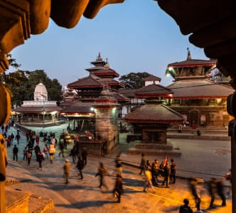
- The southern slope of Mount Everest is in Nepal. Here it lies within the famed Sagarmatha National Park, a UNESCO World Heritage Site.
- The northern face of Mount Everest is located in Tibet, China, specifically in the Tingri County of Xigazê Prefecture.
Local Names: How Do Nepal and Tibet Refer to Mount Everest?
- In Nepal, the mountain is famously called Sagarmatha, meaning “Peak of Heaven,” reflecting its spiritual and cultural importance.
- In Tibet, it is known as Chomolungma, which translates to “Goddess Mother of the World.”
The Himalayan Mountain Range
Understanding where is Everest located naturally involves situating it within the greater Himalayan mountain system. Everest is part of the Mahalangur Himal sub-range, which contains some of the tallest peaks on Earth.
The Himalayas stretch across five countries:
- Nepal
- China (Tibet Autonomous Region)
- India
- Bhutan
- Pakistan
Among these, Mount Everest stands out as the highest peak on Earth, making its location a global geographic landmark and a climbing magnet.
The Height of Mount Everest: How Tall Is Everest?
One of the highest search intents around where is Everest also relates to its height.
As of the official joint announcement by the governments of Nepal and China in December 2020, the precise height of Everest is 8,848.86 meters (29,031.7 feet) above sea level.
This updated elevation is considered the most accurate measurement of the summit’s altitude, settling earlier discrepancies and incorporating tectonic shifts.
Why Knowing Where Everest Is Located Matters for Climbers
Popular Climbing Routes: South vs. North Side
When searching for where is Mount Everest located, a key curiosity follows: “Which is the best route to climb Mount Everest?”
The location affects climbing through two primary approaches:
| Climbing Route | Country | Difficulty Level | Key Features and Accessibility |
|---|---|---|---|
| South Col Route | Nepal | Moderate to Difficult | Classic route; easier logistics; Sherpa culture |
| North Col & Northeast Ridge | Tibet | Difficult and Technical | Less crowded; harsher weather; requires permits from China |
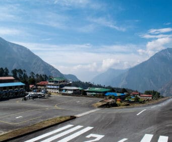
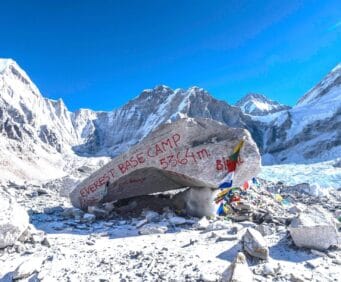
The South Base Camp in Nepal serves trekkers and climbers with a famous multi-day approach from Lukla, offering immersive cultural experiences along the Everest Base Camp trek.
Meanwhile, the North Base Camp in Tibet can be accessed by vehicle due to better road infrastructure, a factor related to Everest’s location on the China-Nepal border.
Accessibility Factors Based on Where Everest Is
- Where is Everest in Nepal?
The southern approach lets adventurers trek through mountain villages, alpine forests, and rhododendron forests, making it one of the world’s most popular trekking experiences. - Where is Everest in China?
The northern route features a higher-altitude starting point with stark vistas and simpler vehicle access to base camp but with tougher weather conditions.
Environmental and Climatic Realities Around Mount Everest
Climate
- Nepal Side: Experiences a South Asian monsoon climate with warm, wet summers and cold, dry winters.
- Tibet Side: Exhibits an arid, high-altitude plateau climate with colder and drier conditions year-round.
- Summit Conditions: Expect extreme cold with temperatures dropping below -20°C (-4°F), fierce winds exceeding 160 km/h, and oxygen levels falling to about one-third of sea level, making the summit a deadly environment.
How Climate Change Is Affecting?
Global warming impacts glaciers and weather patterns around Everest. Rapid glacier retreat is causing more frequent avalanches and increasing risks for both climbers and local communities.
Sagarmatha National Park
The Sagarmatha National Park is a UNESCO-listed park in Nepal that contains the southern face of Mount Everest, officially answering the question where is Mount Everest in Nepal.
- The park covers 1,148 sq km.
- It is home to endangered species like the snow leopard and red panda.
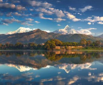
- It offers stunning views of Everest’s southern slopes, Lhotse, Makalu, and Cho Oyu—some of the highest peaks on Earth.
Cultural and Historical Significance
- The first successful ascent of Mount Everest was achieved on May 29, 1953 by the legendary duo Sir Edmund Hillary and Tenzing Norgay, marking a milestone in human exploration.
- The naming of Mount Everest honors Sir George Everest, the British surveyor-general who first calculated the mountain’s height, while local names (Sagarmatha and Chomolungma) reflect indigenous cultural ties.
- The mountain’s location on the Nepal-China border has shaped diplomatic and tourism policies regarding permits, climbing seasons, and environmental conservation.
Frequently Asked Questions
Is Mount Everest in Nepal or China?
It lies directly on the border between Nepal and China (Tibet Autonomous Region). Its southern slopes belong to Nepal, and northern slopes fall in Tibet, China.
Can You Visit Both Nepal and Tibet’s Everest Base Camps?
Yes. You can choose to trek to the south base camp in Nepal or drive to the north base camp in Tibet, China. Both routes offer unique experiences tied to their geography and culture.
What Are the Coordinates of Mount Everest?
The mountain is at 27.9881°N latitude and 86.9250°E longitude, directly pinpointing its position on the Nepal-China border.
How High Is Mount Everest?
It is officially 8,848.86 meters (29,031.7 feet) tall, recognized by both Nepal and China.
What Is the Best Time/Season to Visit?
Typically, the spring months (April-May) and autumn months (September-November) are best for trekking and climbing on either side, when weather conditions are most stable.
Key Mount Everest Facts
| Feature | Details |
|---|---|
| Location | Border of Nepal and Tibet (China) |
| Official Height | 8,848.86 meters (29,031.7 feet) |
| Local Names | Sagarmatha (Nepal), Chomolungma (Tibet, China) |
| Coordinates | 27.9881°N, 86.9250°E |
| Protected Areas | Sagarmatha National Park (Nepal), Qomolangma Nature Reserve (Tibet) |
| Popular Climbing Routes | South Col (Nepal), North Col/Northeast Ridge (Tibet) |
| First Ascent | 1953, Edmund Hillary & Tenzing Norgay |
Summary
In summary, it is uniquely situated on the international border, splitting Nepal and the Tibet Autonomous Region of China. This location shapes its access routes, cultural significance, and environmental context.
By knowing exactly where is Mount Everest located, climbers can select their preferred approach, understand regional climate differences, and appreciate the historical importance of the world’s highest peak.
Recent Posts